We’ve all been in the room when that one Husky fan blurted out, “I don’t know why anyone would go to the Palouse. It’s a desert.” Or that one new department chair that said, “I’ve seen what the region has to offer,” before quickly leaving. For everyone else, who are still open to discovery, this list is for you.
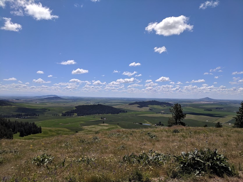
Before we start the list let’s get our bearings straight. The Palouse is the local name for a distinct climate region in Southeastern Washington characterized by low grassy hills. The origin of the regional name ‘Palouse’ is unknown. It literally translates in French to a word for a region of low grassy hills. However, the native tribe of the Palouse referred to themselves with a similar sounding name. Regardless, many settlers, including my ancestors, stayed here because of the incredible potential and character of the region. We’ll start at the top and work our way down.
1. Magic Mountains
If you don’t know why the natives considered the Kamiak and Steptoe Buttes as “Magic Mountains” then you need to go see them for yourself. It might be that Steptoe is literally a giant mountain of quartz in an ocean of basalt. It could be that Kamiak turns gold in the spring with the Balsam bloom. Regardless, knowing the history of these Buttes and how they were set aside as parks is part of understanding the Palouse. Read the story of how Virgil T. McCroskey created Mary McCroskey State Park sometime to learn about one of the region’s true heroes.
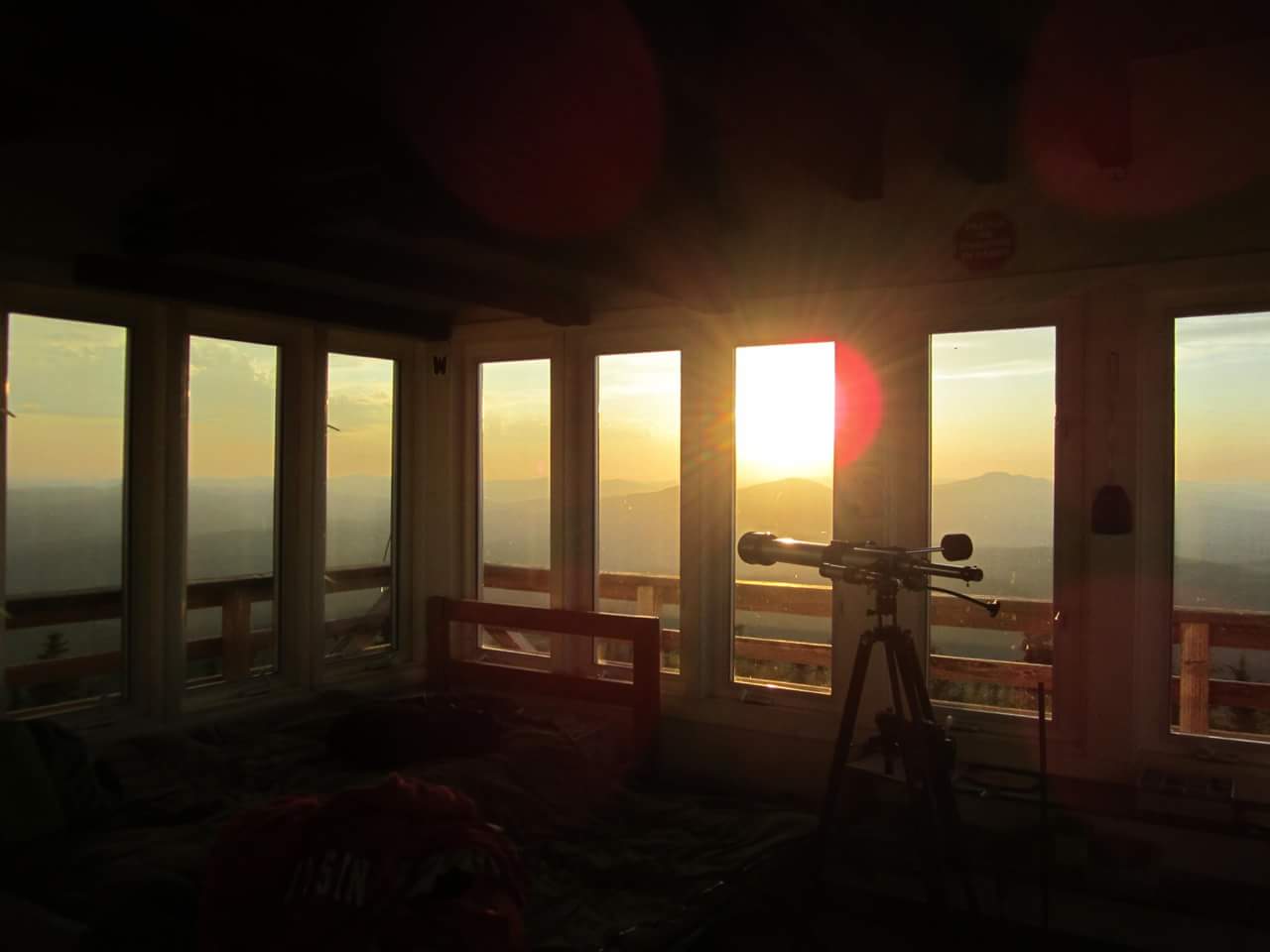
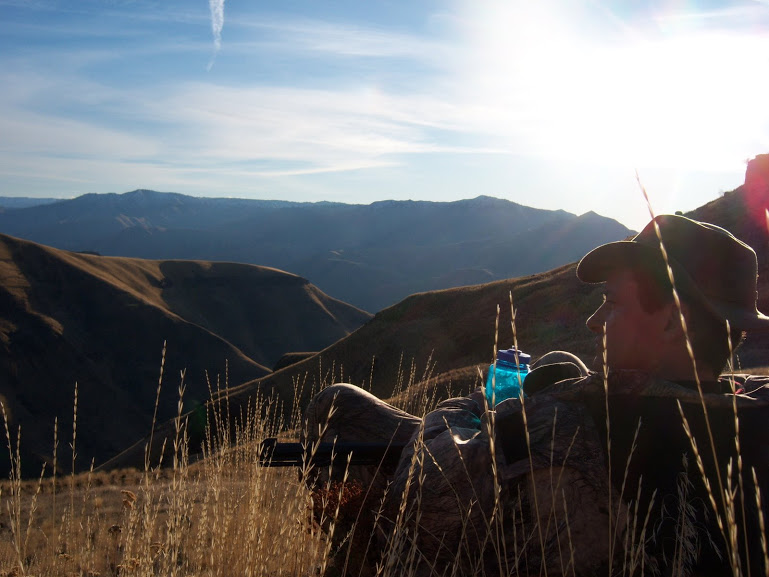
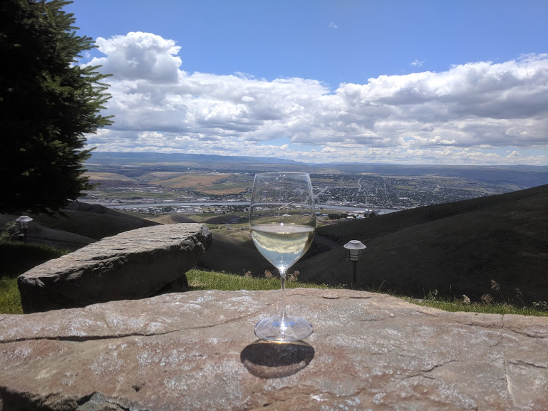
There is a scene towards the end of “Ready Player One” where the team flies to the mansion in the Wallowa Mountains that flank the southern boarder of the Palouse in Oregon — it’s called the Eastern Swiss Alps for a reason. For the life of me, I can’t find my photos of the Wallowas. It might be that the image is so ingrained in my memory that I believe they are images, but never took them. There was a moment on one drive back when we stopped outside Flora to take in the view. The snow-capped Wallowas to the south, the Blue Mountains to the west, and the Grand Ronde canyon below… It gives a person perspective, like this shot from the Bald Mountain Fire Lookout in the Hoodoo Mountains.
2. Hell’s Canyon
The Southern boundary of the Palouse is defined by Hell’s Canyon — the deepest river gorge in North America at 7,993 ft — formed between the Wallowa and Seven Devil Mountains. As you’ll find in this post, settlers to the region were pretty straight-up when naming things. My Grandfather grew up herding cattle in Hell’s Canyon before World War 2, after which it was outlawed. He would tell stories of outlaws who’d escape into Hell’s Canyon to hide their loot, catching gigantic sturgeon with lamb legs on set-lines, building many of the Fish and Game cabins you can stay in today… I came to know the draws in the canyon by the number of snakes they could support.
While there’s many ways to experience Hell’s Canyon, there’s no right way. You can arrange white-water rafting trips through UREC, or rent a jet boat ride if you’re not feeling adventurous. One thing to know, this country is as big up and down as it is wide. Roads are built where and if they can be, so expect to have to get off the beaten path to get the real experience.
3. National Forests and Streams
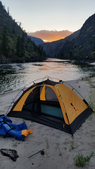
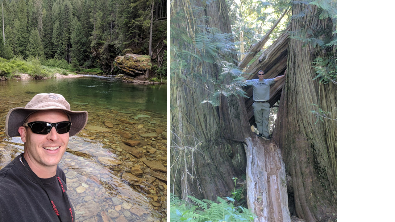
The Palouse is surrounded on three sides by the Colville, Couer d’Alene, St. Joe, Clearwater, Nez-Perce, and Wallowa-Whitman National Forest Districts. Together they make up the largest unbroken stretch of National Forest in the lower 48. Each one has incredible trout fishing streams and rivers — the Lochsa, Selway, Clearwater, St. Joe, Couer-d’Alene, St. Maries — it doesn’t matter, pick one in late July through August, find a soft sandy beach, and sit in the crystal clear water. The water is so clear you can see trout behind nearly every boulder with a pair of polarized glasses.
Just east of Moscow and Pullman you can go to the Hobo and Perkins Cedar groves, as well as see the Giant Cedar — the largest tree east of the Cascades in North America. It’s not the one in the picture below. I won’t take the thrill of it away from you.
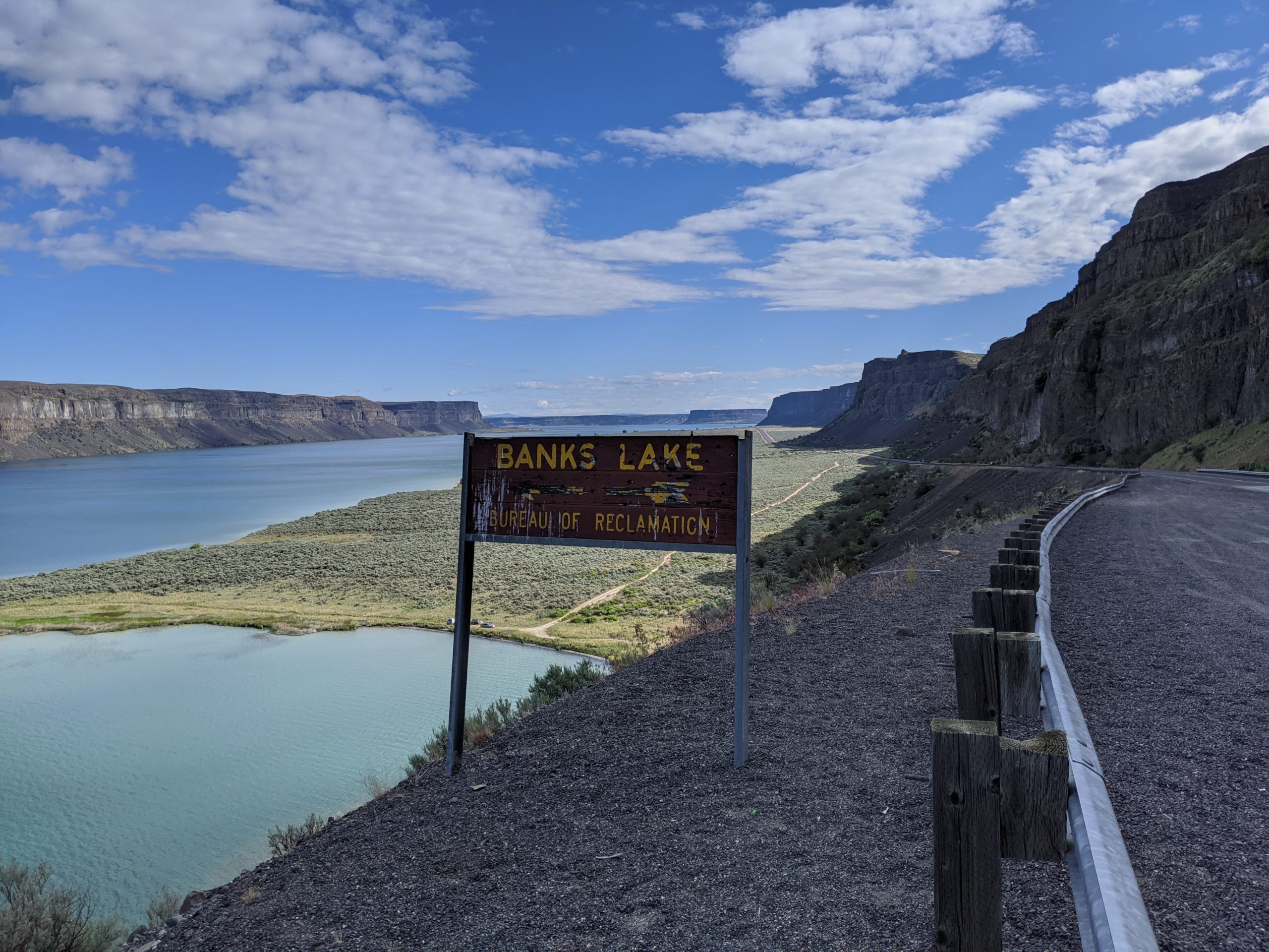
4. Grand Coulees
The Palouse is probably home to the highest percentage of population in the world that knows the definition of the word Coulee: a deep ravine or lava flow. The Northwestern border of the Palouse is lined with many of these Coulees formed by the great Columbian floods which occurred at the end of the ice-age. Large ice dams would build up in Montana and suddenly break free, washing the Columbia basin clean and carving giant ‘scabs’ in the basalt bedrock. One particularly amazing coulee — the Grand Coulee — is now the site of the dam of the same name. This is an incredible hydropower project that uses the Bank’s lake reservoir as a giant pumped hydropower water storage system. Below Bank’s lake is Sun Lake’s state park and Dry Falls — which would’ve been an amazing water fall during one of the floods. You’ll come to know the key geology of the region — Columnar basalt – giant hexagonal columns up the sides of the rock cliffs, amazing. Bowl and Pitcher state park down river of Spokane is a great place to gain an appreciation for this geological formation. Some of the waterfalls in the region are still active, Palouse Falls, Elk Creek Falls, Train Trestle Falls, and many more. One falls into the northern end of Rock Lake in the Northwest corner of Whitman County — a favorite fishing spot. There are unmarked places in the lake where 200+ feet deep rise to 2 feet in an instant so be careful if you go.
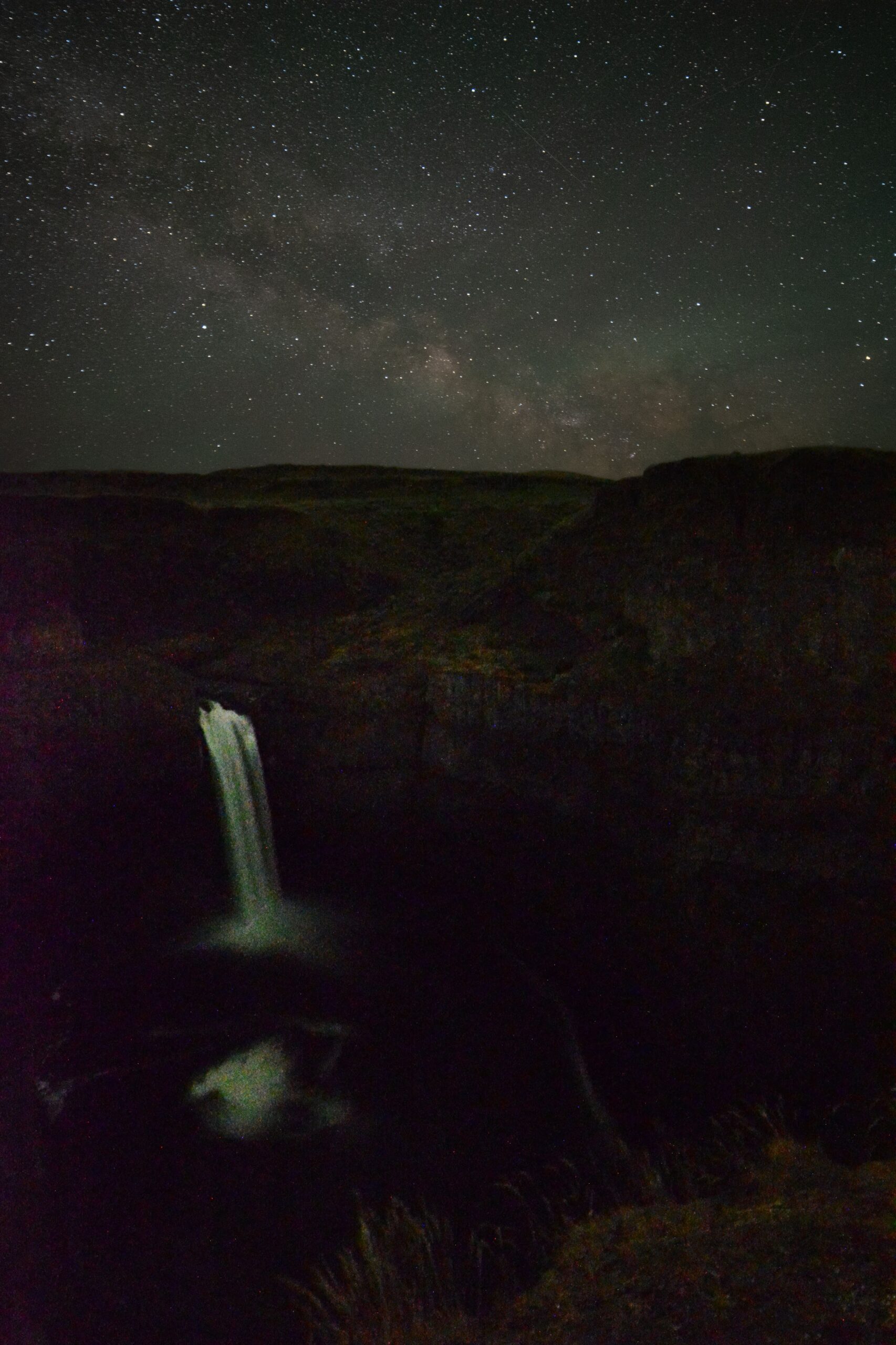
The open expanse of the Palouse makes for solid dark sky. I enjoy getting out to see many astronomy sites. Because our numbers are small, you can talk to people to get special access. We reserved Palouse Falls one night for great dark sky.
5. Terroir
You can thank the Palouse for your pulses and daily breads — Whitman County has been the number one wheat producing county in the US every year since 1978. This also comes at a price — the native Palouse ecosystem is one of the most threatened on the planet, having ~99% converted into farm ground. You can find it if you go looking, Klemgard Park, Rose Creek preserve, the WSU native arboretum, and the Snake river breaks are places to start.
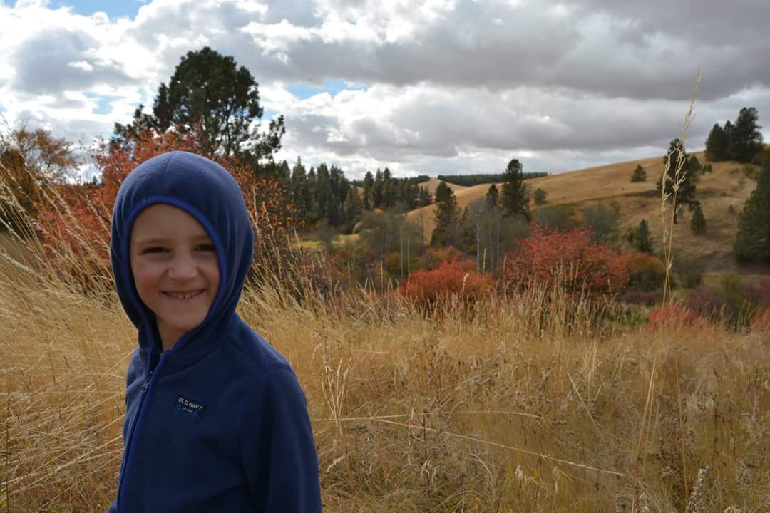
Go on a good morning in early spring or late September to a native Palouse remnant, ideally with some Basalt outcropping. Wait for the sun to warm the rocks and earth. Smell the earth. That’s terroir. You’ll pick it up from wines grown in the LC-Valley AVA. I can’t stop smiling when I taste it.
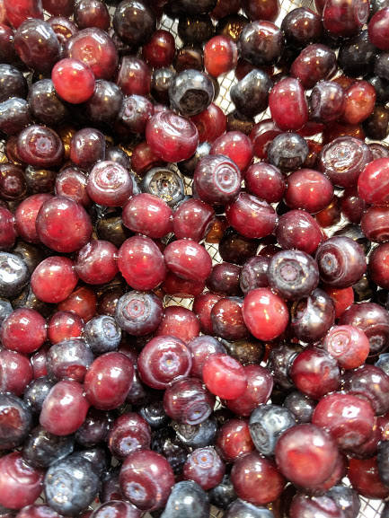
And if you’ve never smelled a pail full of fresh picked huckleberries, I’m not sure you’ve lived.
6. The Universities
The Palouse is the grand connector between all of these amazing places and things. And a cultural role has emerged much like it’s geological bedrock. The Palouse has two Land Grant Universities right in it’s heart: Washington State University and the University of Idaho. People come to these schools to gain the foundational knowledge to connect and propel them into life-long careers. The cycle of students brings a continual renewal of energy and spirit, much like the green grasses in the spring as they mature to brown in the fall, only to begin anew in the spring.
It’s probably this character that has made Moscow the #1 city in the State of Idaho to raise children, Pullman the #1 in the State of Washington. You don’t get both by accident. It’s also why Pullman is a top ten location in the US to start a business. And it’s probably why I chose to come back here for my career.
While this list is by no means complete, it’s a place to start. Much like the universities, the Palouse won’t simply give up it’s riches, but somehow, along the way, you end up changed and more mature — a certain character.
(Follow up — sometimes it’s helpful to have a more specific list of hiking trails.)
I’ll start near and work out:
1) The WSU and UI arboretums
2) Rose Creek Nature Preserve (Palouse remnant)
3) Klemgard hiking trail (shrub-step Native Palouse)
4) Kamiak + Steptoe Buttes
5) Phillips Farm + Moscow Mountain hiking trail network
6) Robinson Park Trails east of Moscow
7) Nisqually John Hunting Preserve
8) Giant White Pine Campground Trails network (you can rent Bald Mt Fire Lookout at the top)
9) Spring Valley Reservoir Trails
10) Micca Mountain Mine and trail
11) Little Boulder Creek Trail network south of Helmer, ID
12) Mary McCroskey State Park and my hero Virgil McCroskey
13) Turnbull Wildlife Refuge south of Cheney
14) Heyburn Lake St Park trail systems
15) Emerald Creek Garnet Dig + Fossil Bowl dig by Clarkia (pronounced Clarkee, same with Kooskia pronounced Kooskee)
16) Elk Creek Falls
17) Giant Cedar north of Elk River
18) Historic Hobo Cedar Grove, Camp, Cornwall Steam Donkey, the Inclined Railroad, Marble Creek trail system
19) Grandmother Mt + Freeze out Saddle Trail system
20) St Joe River + Hiawatha trail bike ride
21) North Fork of Couer d’Alene area
22) Blue Mountains +Umatilla Nt Forest, Wanapam river trail into Troy + Grand Ronde River
23) Hell’s Canyon Trail System (serious) + Kirkwood Ranch (backpacking)
24) Selway + Lochsa Rivers, specifically Warm Springs, Weir Creek hot springs, and Stanley Hot Springs (backpacking)
25) Once you make it this far, you’re backpacking into the Willowas, 7 Devil’s, Buffalo+ Gospel Humps, and the Mallard-Larkins.
And there are many, many more.